This is a list of listed buildings in the parish of Glenelg in Highland, Scotland.
List[edit]
| Name | Location | Date Listed | Grid Ref. [note 1] | Geo-coordinates | Notes | LB Number [note 2] | Image |
|---|---|---|---|---|---|---|---|
| Railway Houses, Mallaig | 57°00′15″N 5°49′51″W / 57.004293°N 5.830905°W | Category B | 13037 | 
| |||
| Glenelg Village 2 Terraces In Main Street Including Post Office, No 4 Glenelg, Miss Chisholm's And Drumfern (All Former Officers' Quarters; 4 Dwellings To Each Side Of Road) | 57°12′47″N 5°37′18″W / 57.213008°N 5.621794°W | Category B | 7237 | 
| |||
| Bernera Barracks | 57°12′58″N 5°37′12″W / 57.216142°N 5.620063°W | Category A | 7252 | 
| |||
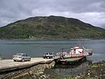
| Glenelg Slipway (Kylerhea Ferry) | 57°13′45″N 5°39′20″W / 57.229171°N 5.655655°W | Category B | 51306 | 
| |||
| Mallaig Station | 57°00′21″N 5°49′46″W / 57.005934°N 5.829574°W | Category C(S) | 43567 | 
| |||
| Knoydart, Kilchoan Square Burial Ground | 57°01′47″N 5°39′43″W / 57.029629°N 5.662002°W | Category B | 7229 | 
| |||
| Byres At Right Angles To And Behind Nos 5, 6, 7, 8 Corran | 57°07′27″N 5°33′08″W / 57.12419°N 5.552181°W | Category B | 7232 | 
| |||
| Eilanreach Barn | 57°11′57″N 5°37′51″W / 57.199235°N 5.630813°W | Category B | 7234 | 
| |||
| 5, 6, 7, 8 Corran | 57°07′28″N 5°33′10″W / 57.124383°N 5.552662°W | Category B | 7253 | 
| |||
| Balcraggie (Former Glenelg Manse) | 57°13′01″N 5°35′47″W / 57.216968°N 5.596348°W | Category B | 7251 | 
| |||
| Kinloch Hourn, Cottage To South Of Steading (Lochournhead House) | 57°06′16″N 5°23′09″W / 57.104307°N 5.385906°W | Category B | 13443 | 
| |||
| Knoydart, Inverie, Scottas House | 57°02′29″N 5°42′39″W / 57.04128°N 5.710815°W | Category B | 7226 | 
| |||
| Knoydart, Kilchoan Round Burial Ground | 57°01′47″N 5°39′43″W / 57.029783°N 5.661935°W | Category B | 7228 | 
| |||
| Mallaig Roman Catholic Church Of St Patrick | 57°00′16″N 5°49′49″W / 57.004572°N 5.830308°W | Category C(S) | 7230 | 
| |||
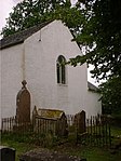
| Glenelg Church (Church Of Scotland) And Graveyard | 57°12′42″N 5°37′27″W / 57.211674°N 5.624099°W | Category B | 7235 | 
| |||
| Kinloch Hourn Steading, (The Farm) | 57°06′17″N 5°23′09″W / 57.10464°N 5.385903°W | Category C(S) | 7224 | 
| |||
| Knoydart, Inverie House | 57°01′57″N 5°40′15″W / 57.032605°N 5.670869°W | Category B | 7225 | 
| |||
| Kylerhea Ferry Old Ferry Inn | 57°13′51″N 5°39′19″W / 57.230772°N 5.655333°W | Category B | 7238 | 
| |||
| Bracorina, Former Chapel Subsequently School | 56°58′12″N 5°44′37″W / 56.970046°N 5.74364°W | Category C(S) | 7223 | 
| |||
| Glenelg War Memorial | 57°12′40″N 5°37′43″W / 57.211014°N 5.628607°W | Category A | 7236 | .jpg)
| |||
| Knoydart, Inverie, Church Of Scotland | 57°02′08″N 5°40′49″W / 57.035688°N 5.680392°W | Category C(S) | 7227 | 
| |||
| Morar Roman Catholic Church Of St Cumin And Presbytery | 56°58′06″N 5°48′31″W / 56.968221°N 5.808512°W | Category C(S) | 7231 | 
| |||
| Corran, Fishing Stores | 57°07′26″N 5°33′15″W / 57.123825°N 5.554262°W | Category B | 7233 | 
|
Key[edit]
The scheme for classifying buildings in Scotland is:
- Category A: "buildings of national or international importance, either architectural or historic; or fine, little-altered examples of some particular period, style or building type."[1]
- Category B: "buildings of regional or more than local importance; or major examples of some particular period, style or building type, which may have been altered."[1]
- Category C: "buildings of local importance; lesser examples of any period, style, or building type, as originally constructed or moderately altered; and simple traditional buildings which group well with other listed buildings."[1]
In March 2016 there were 47,288 listed buildings in Scotland. Of these, 8% were Category A, and 50% were Category B, with the remaining 42% being Category C.[2]
See also[edit]
Notes[edit]
- ^ Sometimes known as OSGB36, the grid reference (where provided) is based on the British national grid reference system used by the Ordnance Survey.
• "Guide to National Grid". Ordnance Survey. Retrieved 12 December 2007.
• "Get-a-map". Ordnance Survey. Retrieved 17 December 2007. - ^ Historic Environment Scotland assign a unique alphanumeric identifier to each designated site in Scotland, for listed buildings this always begins with "LB", for example "LB12345".
References[edit]
- All entries, addresses and coordinates are based on data from Historic Scotland. This data falls under the Open Government Licence
- ^ a b c "What is Listing?". Historic Environment Scotland. Retrieved 29 May 2018.
- ^ Scotland's Historic Environment Audit 2016 (PDF). Historic Environment Scotland and the Built Environment Forum Scotland. pp. 15–16. Retrieved 29 May 2018.