Vitor Meireles | |
|---|---|
| Municipality of Vitor Meireles | |
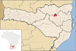
 Location of Vitor Meireles | |
| Coordinates: Coordinates: 26°52′51″S 49°49′58″W / 26.88083°S 49.83278°W | |
| Country | |
| Region | South |
| State | |
| Mesoregion | Vale do Itajai |
| Government | |
| • Mayor | Bento Francisco Silvy |
| Area | |
| • Total | 143.253 sq mi (371.024 km2) |
| Elevation | 1,210 ft (370 m) |
| Population (2020)[1] | |
| • Total | 4,943 |
| • Density | 35/sq mi (13/km2) |
| Time zone | UTC -3 |
| HDI (2010) | 0.673 – medium[2] |
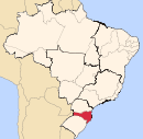
Vitor Meireles is a municipality in the state of Santa Catarina in the South region of Brazil.[3][4][5][6]
See also[edit]
References[edit]
- ^ IBGE 2020
- ^ "Archived copy" (PDF). United Nations Development Programme (UNDP). Archived from the original (PDF) on July 8, 2014. Retrieved August 1, 2013.
{{cite web}}: CS1 maint: archived copy as title (link) - ^ "Divisão Territorial do Brasil" (in Portuguese). Divisão Territorial do Brasil e Limites Territoriais, Instituto Brasileiro de Geografia e Estatística (IBGE). July 1, 2008. Retrieved December 17, 2009.
- ^ "Estimativas da população para 1º de julho de 2009" (PDF) (in Portuguese). Estimativas de População, Instituto Brasileiro de Geografia e Estatística (IBGE). August 14, 2009. Retrieved December 17, 2009.
- ^ "Ranking decrescente do IDH-M dos municípios do Brasil" (in Portuguese). Atlas do Desenvolvimento Humano, Programa das Nações Unidas para o Desenvolvimento (PNUD). 2000. Retrieved December 17, 2009.
- ^ "Produto Interno Bruto dos Municípios 2002-2005" (PDF) (in Portuguese). Instituto Brasileiro de Geografia e Estatística (IBGE). December 19, 2007. Retrieved December 17, 2009.
.svg.png)
.svg.png)

