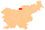
Ludranski Vrh | |
|---|---|
| Coordinates: 46°26′2.88″N 14°51′50.49″E / 46.4341333°N 14.8640250°ECoordinates: 46°26′2.88″N 14°51′50.49″E / 46.4341333°N 14.8640250°E | |
| Country | |
| Traditional region | Carinthia |
| Statistical region | Carintha |
| Municipality | Črna na Koroškem |
| Area | |
| • Total | 18.92 km2 (7.31 sq mi) |
| Elevation | 1,039.2 m (3,409.4 ft) |
| Population (2020) | |
| • Total | 92 |
| • Density | 4.9/km2 (13/sq mi) |
| [1] | |
Ludranski Vrh (pronounced [ˈluːdɾanski ˈʋəɾx]) is a dispersed settlement in the hills south of Črna na Koroškem in the Carinthia region in northern Slovenia.[2]
Name[edit]
The name Ludranski Vrh is believed to be a corruption of Luteranski Vrh (literally, 'Lutheran Peak'). In the past, there were many Lutherans living in the area around Črna na Koroškem.[3]
Landmarks[edit]
Najevnik linden tree[edit]
The Najevnik linden tree (Slovene: Najevska lipa, Najevnikov lipovec) in Ludranski Vrh, an about 700 years old Tilia cordata, is the tree with the largest girth in Slovenia (10.70 meters; its height is 24 m).[4] The tree is named after the Najevnik Farm.[5] It is a prominent veteran tree reminiscent of the Ottoman invasions and the legendary King Matjaž.[6] It is a place of cultural events, and every July or June a national meeting of Slovene politicians takes place under it.[4][7]
References[edit]
- ^ Statistical Office of the Republic of Slovenia
- ^ Črna na Koroškem municipal site
- ^ Savnik, Roman (1980). Krajevni leksikon Slovenije, vol. 4. Ljubljana: Državna založba Slovenije. p. 476.
- ^ a b Šmid Hribar, Mateja. "Najevska lipa" [Najevnik Linden Tree]. In Šmid Hribar, Mateja; Golež, Gregor; Podjed, Dan; Kladnik, Drago; Erhartič, Bojan; Pavlin, Primož; Ines, Jerele (eds.). Enciklopedija naravne in kulturne dediščine na Slovenskem – DEDI [Encyclopedia of Natural and Cultural Heritage in Slovenia] (in Slovenian). Retrieved 28 August 2013.
- ^ Zavod Republike Slovenije za varstvo narave. Najevska lipa. (in Slovene)
- ^ Repanšek, Marta (2004). Večna ura, Folklorne pripovedi iz Črne in okolice [The Eternal Hour: Folklore Stories from Črna and the Surroundings] (in Slovenian). Črna na Koroškem. pp. 277–278. OCLC 442964984.
- ^ "Srečanje pod Najevsko lipo letos povezano z letom kralja Matjaža" [This Year the Meeting Under the Najevnik Linden Tree Was Linked with the King Matjaž Year] (in Slovenian). Slovene Press Agency. 22 June 2012.
External links[edit]


